NASA’s Operation IceBridge closed out its 2012 Antarctic season with two surveys of Antarctic glaciers and two long-awaited flights over sea ice in the Weddell Sea. These four flights bring the airborne science campaign to a successful end with a total of 16 science missions and a total mileage equivalent to more than three times around the Earth’s equator. In addition, researchers on the DC-8 answered questions from students in several U.S. states and Chile by text chat through the aircraft’s communication system.
On Nov. 2, IceBridge mission planners reached into the playbook for a high-priority mission in a high-priority region. When the IceBridge science team met earlier this year to plan Antarctic campaign flights, they categorized each flight based on the survey’s priority and the priority of the region each target is in. After takeoff and transit, the IceBridge DC-8 began a grid survey of the upper part of the Filchner Ice Shelf just offshore of Recovery Glacier. By flying back-and-forth lines spaced 12 miles apart, IceBridge researchers were able to gather data that will enable researchers to calculate the bathymetry, or water depth, below the floating ice in this area. In addition, the gravimeter aboard the DC-8 collected high-altitude gravity readings over the southern Weddell Sea.
IceBridge returned to western Antarctica to survey ice stream tributaries along the flanks of the Pine Island Glacier. This glacier and others in the same region of western Antarctica have been the focus of study in recent years because of a high rate of surface elevation changes, but the tributaries along the northern and southern flanks, or edges, of the ice stream have received little attention compared to the rest of the glacier and its ice shelf. IceBridge researchers gathered surface elevation data to create a baseline for characterizing future changes and took radar measurements of the sub-ice bedrock that will be used to model how ice flows through tributary channels into the Pine Island Glacier basin.
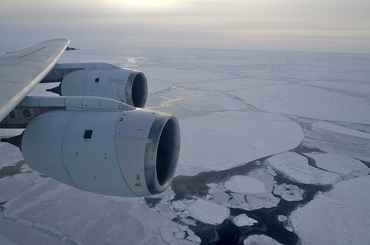
Sea ice conditions during the time of the CryoSat-2 underpass over the Weddell Sea on Nov. 7, 2012. Credit: NASA/Michael Studinger
After a scheduled routine maintenance check of the DC-8 by NASA aviation technicians on Nov. 5, IceBridge returned to the air with clearer weather in the Weddell Sea the following two days. On Nov. 6, the forecast for the northern part of the Weddell Sea looked good enough for a survey closer to the ice edge. By flying under the cloud deck and adjusting altitude as needed, IceBridge researchers were able to take measurements along the entire survey line without losing any data.
On the morning of Nov. 7, IceBridge mission planners spent nearly 45 minutes in the Punta Arenas airport’s weather office looking at forecast models and weighing flight options. “After studying the situation carefully we decided to launch,” said IceBridge project scientist Michael Studinger.
On this final mission of the 2012 Antarctic campaign, IceBridge researchers collected large amount of data on sea ice in the Weddell Sea that will be used in building time-series data of the area. The Nov. 7 survey followed lines previously flown in 2009, 2010 and 2011, which will allow for a year-to-year comparison of those areas. In addition, IceBridge’s flight path intersected an orbit by the European Space Agency’s ice-monitoring satellite, CryoSat-2, with the satellite passing 450 miles overhead during the flight. Data from CryoSat-2 and IceBridge’s radar altimeter will be used to calibrate and validate satellite measurements.
Although the weather in the Weddell Sea was the best that have been seen during the entire campaign, they still weren’t ideal with clouds making for a sometimes difficult survey. Despite the challenging conditions, IceBridge gathered a large sum of sea ice data, including a satellite underpass and a loopback pattern on CryoSat’s ground track to measure sea ice drift. “Kudos are due to the crew in the cockpit for continuing survey operations in marginal conditions,” Studinger said.


