


NASA’s Operation IceBridge flew two more surveys on Oct. 25 and 27 that gathered more information on changes in ice surface elevation and took a look below the ice to measure water depth and bedrock topography. In addition, on the Oct. 25 flight, IceBridge was joined by two guests, the U.S. Ambassador to Chile, Alejandro Wolff, and his Secretary for Economic Affairs, Josanda Jinnette.
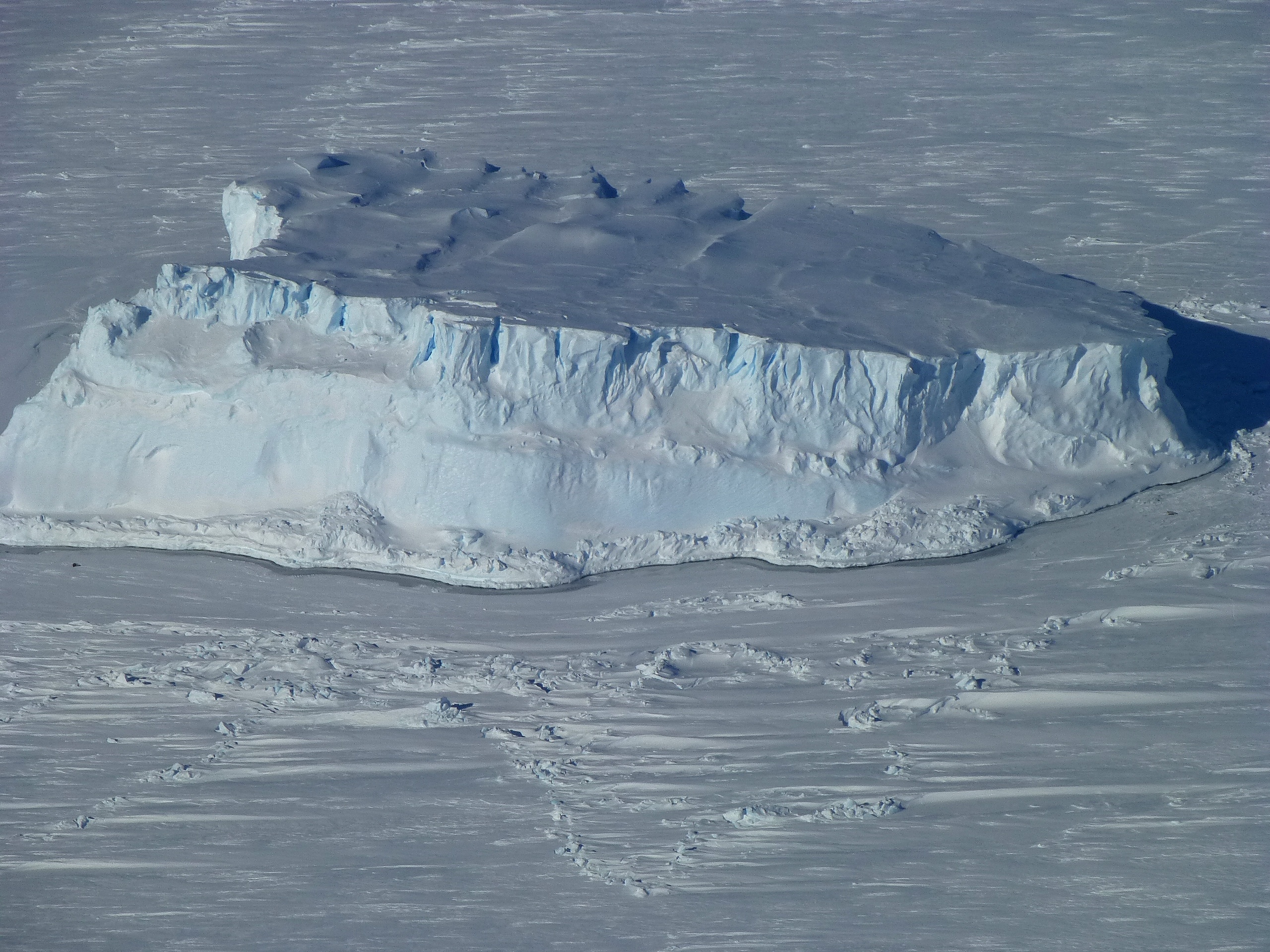
The Oct. 25 mission measured ice surface elevation in the region around the Ferrigno and Alison Ice Streams to see how things have changed in these streams that empty into the Bellingshausen Sea west of the Antarctic Peninsula. The newly designed mission measured upstream of the grounding line in a six-line east to west grid parallel to the coast. Lines were spaced six miles apart, each running farther inland, and the western end of each one intersected a previous survey line flown by the Land, Vegetation and Ice Sensor. By intersecting previously measured lines, IceBridge scientists are able to build continuity of data in the area.
IceBridge guests Ambassador Wolff and Ms. Jinnette traveled from Santiago to Punta Arenas on Oct. 24, sat in on the evening science meeting and joined IceBridge personnel for the 11-hour-long flight. NASA has been working closely with the government, scientists and educators of Chile thanks to help from the U.S. Embassy in Santiago. This flight was a chance for Wolff to see an airborne science mission firsthand and was a small token of IceBridge’s appreciation. Later in the campaign, IceBridge will be joined by education and public affairs people from the embassy, a Chilean journalist and two Chilean teachers.
On Oct. 27, IceBridge embarked on a survey of the Getz Ice Shelf region. One of the focuses of this mission is beneath the ice. Using the MCoRDS radar depth sounder and the gravimeter, IceBridge researchers gathered data on land ice bed topography and sub-ice shelf bathymetry. Radar can penetrate through ice down to the bedrock below, giving a picture of the shape of sub-ice terrain. To measure sub-ice water, researchers rely on an instrument known as a gravimeter.
Gravimeters measure variations in the Earth’s gravitational pull in areas with different density. Water is less dense than rock so scientists can distinguish bedrock from water and measure the shape and depth of sub-ice water cavities. “We are measuring changes down to about one part in a million of the Earth’s gravitational field,” said scientist Kirsty Tinto of the Lamont-Doherty Earth Observatory of Columbia University.
In addition, when combined with ice radar, researchers can use gravity readings to infer whether a bed is made of solid rock or sediments. Understanding the shape and nature of the bed and depth of water below ice shelves is important for building more accurate computer models of how ice will change in the future.
With 10 missions down and only a handful of high priority missions left, IceBridge mission planners are keeping an eye on the weather to ensure maximum efficiency. A persistent low pressure system in the Weddell Sea that ATM scientist John Sonntag said hasn’t been seen in previous years is limiting options. Conditions are set to change soon though. “We have hopes that will change later in the week,” said Sonntag.
For more about Ambassador Wolff’s visit to IceBridge, visit:
http://blogs.nasa.gov/cm/blog/icebridge/posts/post_1351430312784.html
and
en español