Gravimeter
 (NASA P-3B and DC-8; UTIG BT-67)
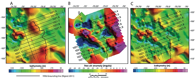
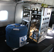
The gravimeter measures the shape of seawater-filled cavities at the edge of some major fast-moving glaciers. Data about the amount of water under ice fills in a crucial gap in knowledge related to calving and melting of glaciers. Water has less mass than rock and thus exhibits a lower gravitational pull, meaning that the gravimeter can show what lies under the ice. The AIRGrav gravimeter, developed by Sander Geophysics (www.sgl.com), uses several sensitive gyroscopes to keep the instrument orientation stable. Accelerometers measure the force of gravity from the Earth below while GPS is used to record, and then remove, the motion of the aircraft.
More details on the AIRGrav system can be found here:http://www.sgl.com/Gravity.html
The University of Texas Institute for Geophysics’ (UTIG) obtains gravimeters for its surveys through leases or partnerships with other agencies.