Ku-Band Radar Altimeter

(NASA P-3B and DC-8)

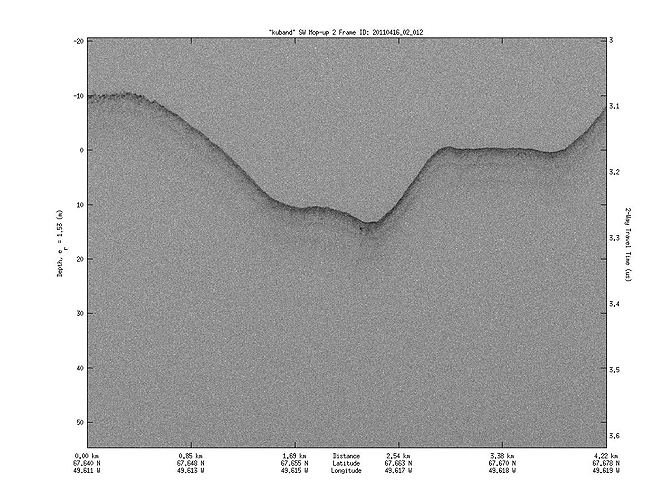
Rounding out the CReSIS instruments is the Ku-Band Radar Altimeter, which penetrates through snow to measure the surface elevation of sea ice and ice sheets and the sea surface. The data from this instrument can be used together with data from ATM to determine the thickness of snow over sea ice.

Data plot from Ku-band radar altimeter

More about Ku-Band Radar
Ku-band Radar data at NSIDC

 
Ice on Antarctica's Ellsworth Mountains, 10/22/2012 Ice on the Ellsworth Mountains in Antarctica as seen from the IceBridge DC-8 on Oct. 22, 2012. The Ellsworth Mountains are home to Antarctica’s highest point, Vinson Massif (16,050 ft / 4,892 m). Credit: NASA / James Yungel