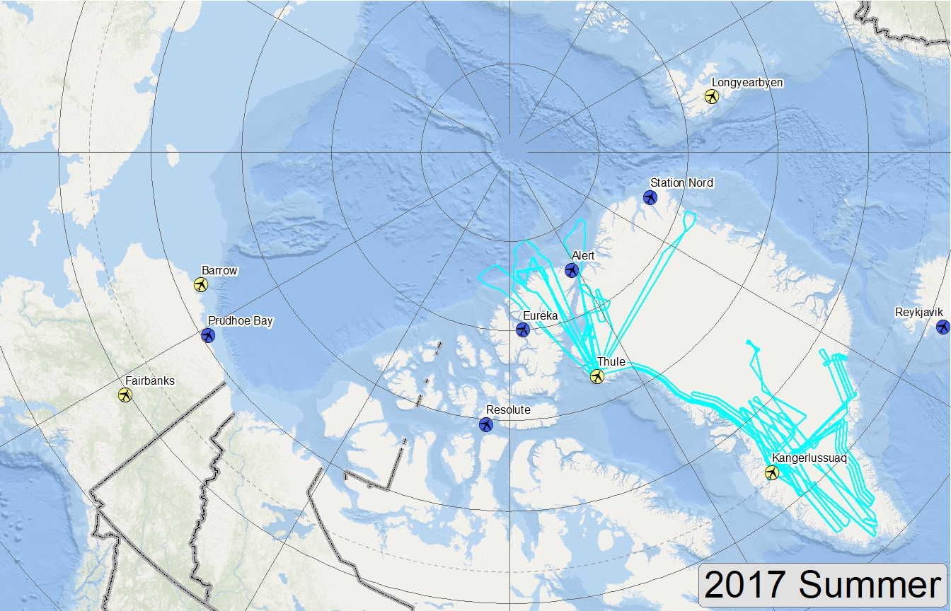
Arctic – 2017 – Summer


Map of 2017 Arctic Summer flight lines


Campaign Documents

  • Adobe PDF of proposed sea-ice flight lines (HU-25 Falcon / NASA)
  • Google Earth kmz of proposed sea-ice flight lines (HU-25 Falcon / NASA)
  • Google Earth kmz of flown sea-ice flight lines (HU-25 Falcon / NASA)
  • Adobe PDF of proposed land-ice flight lines (B-200 / NASA)
  • Excel spreadsheet of proposed land-ice flight lines (B-200 / NASA)
  • Google Earth kmz of proposed land-ice flight lines (B-200 / NASA)
  • Google Earth kmz of flown land-ice flight lines (B-200 / NASA)
  •  
    Ice on Antarctica's Ellsworth Mountains, 10/22/2012 Ice on the Ellsworth Mountains in Antarctica as seen from the IceBridge DC-8 on Oct. 22, 2012. The Ellsworth Mountains are home to Antarctica’s highest point, Vinson Massif (16,050 ft / 4,892 m). Credit: NASA / James Yungel